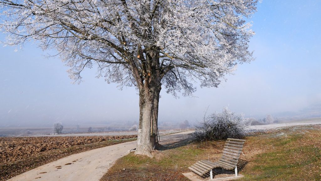
Especially cold nights
Spring is not in full swing yet
3/3/2022, 5:12 PM
Although it’s been spring in terms of meteorology since March 1, the temperatures show something different, especially at night. NTV weather expert Björn Alexander talks about late winter and the feeling of frost when it comes to the week’s forecast.
ntv.de: The sun is playing well these days. But especially at night it feels like it’s in the depths of winter. When does spring begin to boil even with the temperatures?
Bjorn Alexander: Right now, things are still completely missing from the spring mechanism. Because even if the sun retains control over the weekend, it will unfortunately not yet translate into true spring vibes. On the contrary, because in the coming week, the flow of dry and cold air from the mainland will increase with noticeably increased feeling of cold and sometimes freezing nights.
How long does frost stay with us?
Looking at the weather models yesterday, I was thinking it could get milder out west from the middle of the week. In the meantime, current trends show that frost and ground frost topics may still be on our minds next weekend. Even if the sun spoils us frequently during the day.
There’s plenty of sunshine and hardly any rain here, while in Australia, the sky hardly wants to close its gates – at least in the east of the continent. Do you stay that way
Unfortunately, it doesn’t look good at all. Because in addition to the sometimes devastating rain of the past few days, there is now a lot more to come. Weather computers continue to calculate some heavy rain and thunderstorms for the East Coast, some of which will again be more than 300 liters per square meter around Sydney with a new low storm. For comparison: this corresponds to about half of Berlin’s annual precipitation, which should come from the sky over the next few days.
What will the weather be like from down to Germany and the weekend?
After a frosty start to Saturday, the West and South in particular will get plenty of sun again and often about 9 to 11 hours of sunshine. On the other hand, in the east it is more shade and sometimes there is little snow or snow grains. But it should be enough in the sun for 3 to 6 hours.
How are the temperatures?
After the week’s peak on Thursday, it gradually decreases, so that Saturday has a maximum of between 0 degrees on the Ore Mountains and 10 degrees in the Upper Rhine. Then comes the night that was supposed to be attributed to the winter of 2021/2022, which was very warm by 3 degrees. Away from the moderate stretches of the coast in sea winds, temperatures often drop to minus 2-8 degrees below zero. In the Alpine direction, there are also double negative number degrees. It’s colder at minus 15 in Zugspitze and about minus 20 degrees in Funtensee. However, both are closed to the public.
How is that?
Because of course there is not much going on at night in the Zugspitze at an altitude of almost 3000 metres. The weather station in Funtensee in southern Bavaria is located in a high, uninhabited valley at an altitude of about 1,600 meters and is virtually inaccessible in winter. By the way, minimum levels below minus 20, and sometimes even below minus 40 degrees, are regularly reached here in winter.
Why is it so snowy in there?
In the Funtensee, cold air can build up over a long period of time, causing, for example, the lowest temperature ever recorded in Germany at minus 45.9 degrees in December 2001. However, it should also be noted that the Funtensee station It belongs to a private network and is not affiliated with the official measurement network of the German Weather Service, therefore these freeze values are not included in the list of official records.
How is our weather on Sunday?
It continues during the day over the northeastern half with a mixture of sun and clouds, but it is dry. Meanwhile, the southwestern half is receiving plenty of sunshine again. In addition, temperatures in the lowlands range from 2 to 9 degrees, while light permafrost poundes the mountain.
And the next week?
is the weather cold? At night almost everywhere with frost and during the day with maximum single-digit values. On Mondays and Tuesdays from 0 to 9 degrees, and on Wednesdays and Thursdays even at minus 1 to 8 degrees. An increasingly disturbing and sometimes freezing east wind is blowing, which will make the whole thing even cooler.
What’s the weather?
In addition to a lot of sunshine, there are sometimes cloudy fields. However, most of the time, it remains friendly to the sun and only occasionally can a snowflake fall off. Only at the end of the week do the weather PCs see more clouds and milder air our way. As a result, it is quite certain that March 2022 will end up being an above-average sunny month. The normal would be about 115 hours of sunshine in the long and medium term across Germany. However, whether the second half of the month will be able to compensate for these late-winter cardiogenic consequences in temperature equilibrium is quite doubtful.

“Total coffee aficionado. Travel buff. Music ninja. Bacon nerd. Beeraholic.”


More Stories
Milky Way: discovery of a massive black hole
The new charging method could double battery life
As an early detection method?: Vision problems could indicate Alzheimer's disease