


The whole project is very complicated because it causes a systemic change: in the future, the 1.5 million measurement points distributed across the USA will no longer be used as reference points, but GPS data. Many landmarks in New York such as skyscrapers, mountain peaks or valleys will have different geographical data in the future. Most will be less.
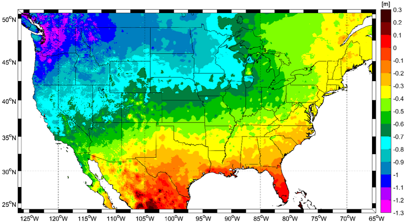
This change is most pronounced on the northwest Pacific coast. Juliana B., President of the National Geodetic Survey (NGS) According to Blackwell, elevation data can vary from the current one to five feet (one and a half meters) and in some parts of Alaska to 6.5 feet (approximately). Two meters). It will be 4.3 feet (1.3 meters) shorter than it is now in Seattle.
Florida “Raised”
The accuracy of the current measurement is high in the northwestern United States and low in the southeast. Florida will be a little more in the future than it is now. Surveyors (geodesists) measure and recalculate the shape and magnitude of the Earth’s gravitational field and define what is called vertical and horizontal data. Average sea level is generally defined as zero. It is determined from values measured over many years.
Real effects
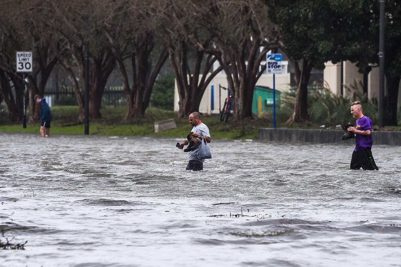
For some in the United States, new height information could become a problem, Blackwell feared in connection with the “New York Times” last year. People in Colorado, for example, are now over a thousand mountain peaks and worried about falling in the future. But in Beaumont, northeast of the Texas city of Houston, being classified as a flood-prone area in the future is likely to have far-reaching consequences. For owners, this means higher insurance costs.
“Elevation Modernization” per centimeter
The major review, officially called “Elevation Modernization”, is part of a broader program by the US National Oceanic and Atmospheric Administration (NOAA). According to the “New York Times” in a detailed report on the project, the purpose is to determine more precisely where the United States is on Earth.
NGS explains the importance of “elevation modernization” when defining flood zones, monitoring changes in sea level, or making a critical change in flight when the aircraft lands in poor view.
The new NSRS (National Space Reference System) measurement system is implemented by the National Geographic Survey (NGS). This will change the old settings from the 1980s, with some values differing significantly from those calculated using the latest methods. The main reason is that the landscape reference points change over time – for example, slightly sinking, eroding or simply disappearing.
Jefferson’s opening shot
As early as 1807, then-US President Thomas Jefferson ordered the beaches to be surveyed in order to make shipping safer. The Coast Guard was created to be the forerunner of today’s NGS and the first scientific government agency in the United States.
With the expansion of the west came the measurement of the interior of the country. Surveyors anchored metal measuring points in the countryside – often at one-mile intervals. Height was calculated from all these points. Anyone who wants to calculate the height of a building or cliff will point to the nearest measuring point. The aim was to have a uniform height system across the United States. This is important, for example, when a bridge was built between two states where the two elements actually met in the middle.
The mounting system was changed five times in the United States during the 20th century – last in 1988. But this was precisely because of the movement of tectonic plates and oil, gas and water production, especially in California and Texas.
The object of foresight
According to Blackwell, the comprehensive plan is rapidly gaining importance in everyday life: the capability it provides to quickly and accurately determine heights and level coordinates will be of crucial importance to drones, self-driving cars and utility. Remote controlled air systems, for example. But the new, accurate data will be important for agriculture, large construction projects and officials monitoring climate and climate change. The calculation of flood risk areas and the early assessment of the effects of storm surges or earthquakes should be very accurate.
Double challenge in Europe
Europe faces similar challenges. Elevation systems here have also grown historically, so – unlike the United States – vary from country to country. The zero point – the surface of the ocean – comes from the monarchy in the local elevation system and represents the Adriatic Sea near the Triestek. In Germany, for example, sea level reference value in the North Sea in Amsterdam. As a result, the Austrian and German elevation systems differ by several decimeters.
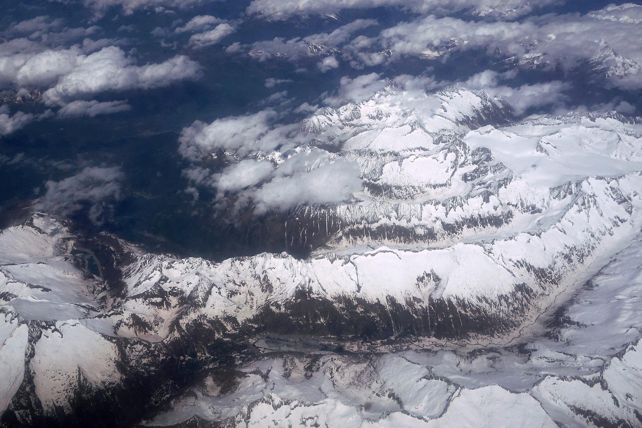
A German-Austrian-Swiss project has been in operation since 2018, initially to standardize the elevation of the alpine area (approximately 100 km around Worrellberg and Tyrol). According to the Federal Office for Meteorology and Surveying (BEV), good progress has been made. Therefore, the expansion of the project to all of Austria’s neighbors and the entire alpine region is currently underway.
For this project, the Federal Office for Meteorology and Surveying (BEV) has been carrying out special gravity measurements with gravimeters in the Alps since 2018. This allows more accurate identification of so-called gravitational anomalies, which refers to local or regional differences in the density and thickness of geological structures on Earth, BEV’s geophysicist Christian Ulrich told ORF.at. With these gravitational data, Geoid is then computed by various research institutes (including the Cross University of Technology) using complex mathematical methods, and the solutions are compared and analyzed.
GPS is not accurate enough
Measurements from satellites (GPS) or aircraft are not accurate enough to calculate precision altitude settings per centimeter. This should be done on the ground. In particular, a grid is set over a country or a continent. Gravity measurements of the earth should be carried out with a gravimeter at a distance of one to a maximum of three kilometers.
In addition, gravity will vary depending on the geographical layer. Geoid is calculated from these data. It corresponds approximately to the average sea level of the oceans and is the decisive surface for calculating elevations. Ullrich firmly believes that in the “Middle Ages” there will be a uniform height system in the European Union or across Europe.
Many years question
In the United States, too, there is the problem of benchmarking and shifting to a new date: for legal reasons (e.g. contracts where measuring points are listed), technical and financial effort and those who have to compare the past with updating current data, change in the United States can only take place gradually and eventually take many years That is expected. According to NGS’s most optimistic scenario, 62 percent of all users (public officials and businesses) would have changed after a decade.
Climate change is changing the shape of the earth
How long the new geoit model will be right is open: Climate change is leading to an increase in sea levels, thus changing the Earth’s gravitational pull. This mass change on the Earth’s surface caused by CO2 emissions “actually changes the shape of the Earth,” said James L. Snyder, a geophysicist at Columbia University. Davis said in an interview with the New York Times.
In Austria, too, climate change is leading to the melting of severe glaciers. This ice mass loss causes a change in gravitational force, which the BEV can measure with high accuracy using absolute gravimeters. Particularly in the alpine region, vertical elevation changes occur due to tectonic activity, so geometry and elevation information can vary in Austria for decades in the centimeter range. To investigate these effects, several monitoring stations are operated on the BEV, which record changes in intensity, level and altitude.

Emily Dickinson writes for Social Post News, covering news, politics, business, technology, sport, entertainment, and lifestyle. She focuses on clear, reliable reporting and useful information, helping readers stay informed about current events, emerging trends, and stories that matter.


More Stories
Meta Expands AI Ambitions With Major Power Investment in Louisiana
US Election: Trump Vs. Harris – 2024 poll numbers in America
Evangelos Marinakis: A Prominent Business Leader and Public Figure